Top 10 Day Hikes in Bavaria
Hiking in Bavaria feels like stepping into a storybook, where every trail leads through whispering forests, wide-open valleys, and misty mountain silence. The air is crisp, the pace unhurried, and there's a quiet joy in simply putting one foot in front of the other.
Who is this for?
This article is for anyone of all levels! There are hikes of ranging difficulties, all with levels from easy to difficult stated as well as the rough time it should take. Be sure to check the weather before going and hopefully you will have a great time!
Related blogs


1. Eibsee Circular Trail
Length (loop) - 7.1km (4.4miles)
Elevation - 229m
Difficulty - Easy
Hiking time - approx. 2 hours
Start: Eibsee
By car from Munich (1hr 30mins)
Public transport (2hrs 25mins): Munich Central -> Garmish Partenkirchen (train) -> Eibsee Bushalt (bus)
Restaurants - see map below!
Highlight of the trail
The Eibsee circular trail wraps gently around a crystal-clear lake at the foot of towering peaks, offering stunning reflections and ever-changing light. It’s an easy, well-marked path that invites slow wandering, with spots to pause and soak in the silence or dip your toes in the water. Forest stretches give way to open views, and the contrast between dense green and turquoise water feels almost unreal. This is a walk for those who want beauty without effort, and calm without crowds—if you time it right.
Weather and map linked below!


2. Kehlsteinhaus (Eagle's Nest)
Length - 15.1km (9.4miles)
Elevation - 1,015m
Difficulty - Difficult
Hiking time - approx. 6 hours 30minutes
Start: Dokumentation Obersalzberg
By car from Munich (2hrs 10mins)
Public transport (3hrs 20mins): Munich Central -> Salzburg Hbf (train) -> Berchtesgaden (bus) -> Dokumentation Obersalzberg (bus)
Restaurants - see map below!
Highlight of the trail
The Eagle’s Nest hike begins with a shaded climb through thick pine forests, where the air is cool and the trail winds steadily uphill over gravel and stone. As you gain height, the trees thin and sweeping views open up—glimpses of Lake Königssee, rugged cliffs, and the snow-dusted peaks of the Bavarian Alps. The final stretch is steeper and more exposed, with tight switchbacks and a palpable sense of elevation before reaching the historic stone building perched dramatically on the mountaintop. Expect a mix of effort and awe: the kind of hike that lingers in your legs and your memory.
Weather and map linked below!


3. Neuschwanstein Two Lakes Loop
Length - 19.6km (12.2 miles)
Elevation - 740m
Difficulty - Moderate
Hiking time - approx. 6 hours
Start: Füssen
By car from Munich (1hr 50mins)
Public transport (2hrs 25mins): Munich Central -> Buchloe (train) -> Füssen (train)
Restaurants - see map below!
Highlight of the trail
The hike from Füssen to Neuschwanstein via Schwansee and Alpsee starts on easy trails around Schwansee, with open views and a peaceful, natural setting. From there, the path leads through light woodland and along the edge of Alpsee, where the mountains rise steeply behind the lake. The route climbs gently as you approach Neuschwanstein, with the castle coming into view through the trees and across the water. It’s a relaxed, scenic walk that combines lakes, forest, and a steady buildup to one of Bavaria’s most famous landmarks.
Weather and map linked below!


4. Zugspitze from Garmisch-Partenkirchen Via Ferrata
Length - 22.5km (14.0miles)
Elevation - 3,300m
Difficulty - Very difficult
Hiking time - full day (very diificult), often done in two days
Start: Garmish Partenkirchen
By car from Munich (1hr 10mins)
Public transport (1hr 20mins): Munich Central -> Garmish Partenkirchen (train)
Restaurants - see map below!
Highlight of the trail
The Zugspitze hike via the via ferrata is a challenging, full-day ascent with a mix of steep hiking, scrambling, and exposed metal rungs fixed into rock. The route begins in the valley and climbs steadily through alpine meadows before entering rugged, high-mountain terrain. The final section involves secured climbing along narrow ridges and steep rock faces, requiring a head for heights and good fitness. At the summit, you're rewarded with panoramic views across four countries, and a real sense of accomplishment after a serious day in the mountains.
Weather and map linked below!


5. Malerwinkel Circular Hike
Length - 3.5km (2.2miles)
Elevation - 170m
Difficulty - Easy
Hiking time - approx. 1 hour 30 minutes
Start: Königssee
By car from Munich (2 hours)
Public transport (3hrs 15mins): Munich Central -> Freilassing (Train) -> Berchtesgaden Hbf (Train)
Restaurants - see map below!
Highlight of the trail
The Malerwinkel circular hike around Königssee is an easy, well-maintained trail that starts near the lake and leads through quiet forest paths with occasional openings to stunning viewpoints. The highlight is the Malerwinkel lookout, offering a classic view over the emerald-green water framed by steep cliffs and alpine peaks. The loop continues gently through woodland and along the lakeshore, with benches and peaceful spots to pause along the way. It’s a short, accessible walk that still delivers some of the most iconic scenery in the region.
Weather and map linked below!


6. Partnach Gorge - Eckbauer
Length - 9.7km (6.0miles)
Elevation - 615m
Difficulty - Moderate to difficult
Hiking time - approx. 4 hours
Start: Garmish Partenkirchen
By car from Munich (1hr 10mins)
Public transport (1hr 20mins): Munich Central -> Garmish Partenkirchen (train)
Restaurants - see map below!
Highlight of the trail
The hike from Partnach Gorge to Eckbauer begins with a dramatic walk through the narrow canyon, where the river thunders between steep rock walls and water drips from above. After the gorge, the trail climbs steadily through forest and open meadows, with views expanding as you gain height. The final stretch to Eckbauer is more relaxed, passing alpine huts and offering wide views over Garmisch and the surrounding peaks. It’s a varied route—cool and shaded at first, then opening up to classic Bavarian mountain scenery.
Weather and map linked below!


7. Schliersee to Tegernsee via the Gindelalm
Length - 11.7km (7.3miles)
Elevation - 580m
Difficulty - Easy to moderate
Hiking time - approx. 4 hours
Start: Schliersee
By car from Munich (1 hour)
Public transport (1 hour): Munich Central -> Schliersee (train)
Restaurants - see map below!
Highlight of the trail
The hike from Schliersee to Tegernsee via the Gindelalm is a scenic ridge walk that starts with a steady forest climb from Schliersee, leading to open alpine pastures around the Gindelalm huts. From there, the trail follows a gentle ridge with wide views over both lakes and the surrounding foothills. It’s a peaceful, rolling route with a mix of forest shade and sunny clearings, often dotted with grazing cows and quiet rest spots. The descent into Tegernsee is gradual and well-marked, ending in a lakeside town perfect for a post-hike swim or coffee.
Weather and map linked below!

8. Kramerspitz
Length - 16.1km (10.0miles)
Elevation - 1,340m
Difficulty - Moderate to difficult
Hiking time - approx. 5 hours
Start: Garmish Partenkirchen
By car from Munich (1hr 10mins)
Public transport (1hr 20mins): Munich Central -> Garmish Partenkirchen (train)
Restaurants - see map below!
Highlight of the trail
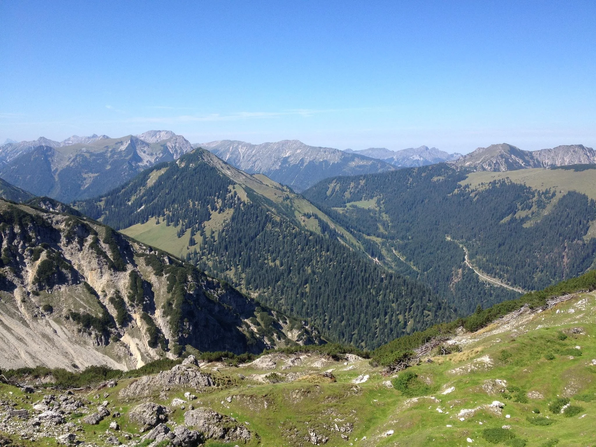
The Kramerspitz hike is a demanding loop that starts right from Garmisch, climbing steeply through dense forest with few breaks as you gain altitude quickly. As you approach the summit, the trees thin out and the views open dramatically, with a sweeping panorama over the Zugspitze range on one side and the Ammergau Alps on the other. The top is quiet and spacious, a rewarding spot after the long climb. The descent is gentler but still long, winding down through alpine meadows and forest before dropping back into town—tough on the legs, but well worth the effort.
Weather and map linked below!


9. Schrecksee
Length - 15.9km (9.9miles)
Elevation - 1,160m
Difficulty - Difficult
Hiking time - approx. 7 hours
Start: Hinterstein
By car from Munich (2 hours)
Public transport (3hrs 45mins): Munich Central -> Sonthofen (train) -> Hinterstein (bus)
Restaurants - see map below!
Highlight of the trail
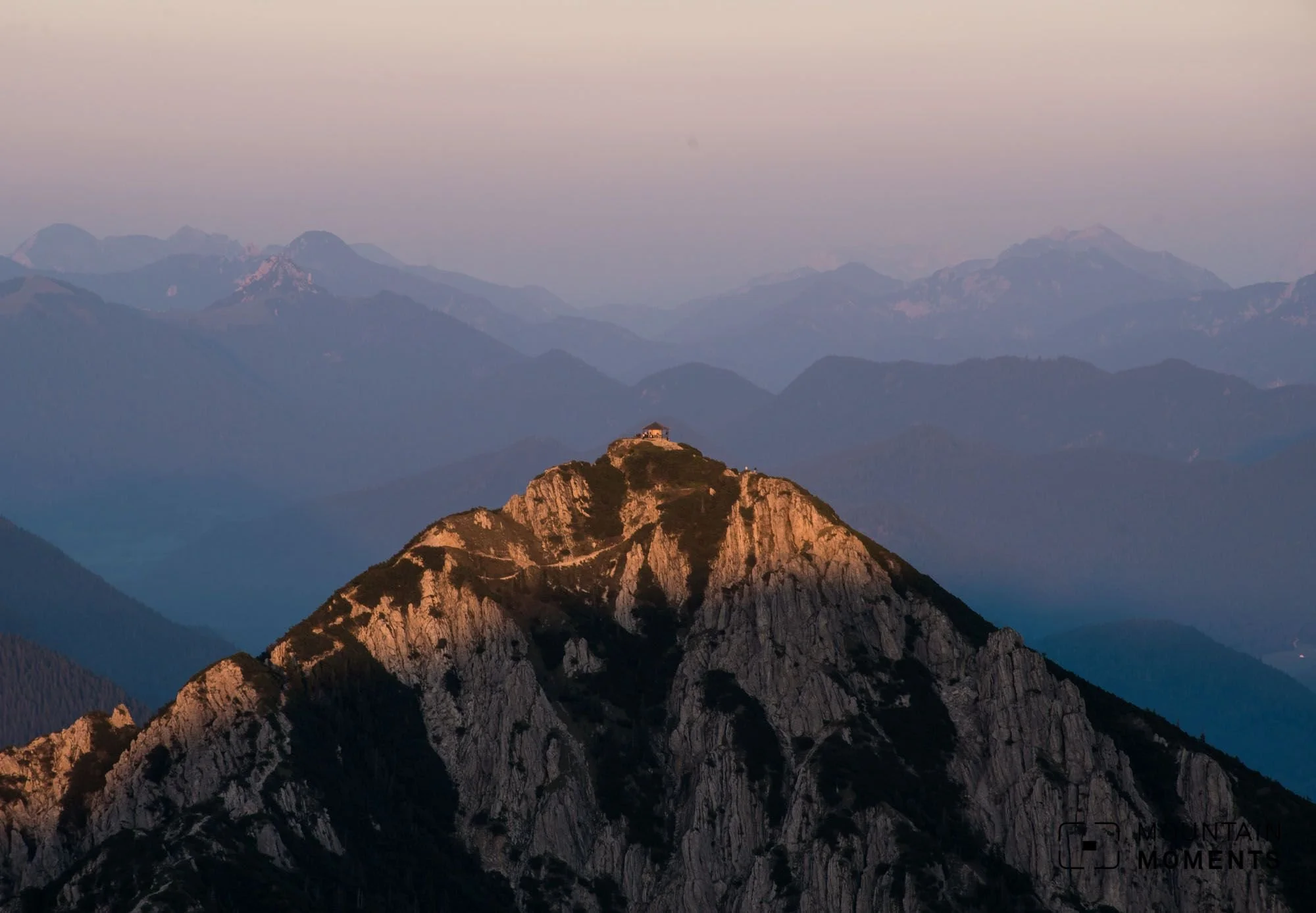
The hike to Schrecksee is a tough but stunning route that begins with a steady climb through forest and open pasture, before steep switchbacks take you high into alpine terrain. As you gain elevation, the landscape becomes more rugged, with rocky trails and panoramic views of the Allgäu mountains. The final approach reveals Schrecksee suddenly—an emerald-green lake nestled in a high valley, often with snow patches lingering even in summer. It’s a challenging out-and-back route, but the dramatic setting and remote feel make it one of the most rewarding hikes in the region.
Weather and map linked below!

10. Herzogstand from Walchensee
Length - 11.1km (6.9miles)
Elevation - 910m
Difficulty - Moderate
Hiking time - approx. 5 hours
Start: Walchensee
By car from Munich (1hr 30mins)
Public transport (1hr 50mins): Munich Central -> Kochel (train) -> Walchensee (bus)
Restaurants - see map below!
Highlight of the trail
The hike to Herzogstand from Walchensee starts with a steady uphill climb through forested switchbacks, offering occasional glimpses of the lake below. As you rise above the treeline, the trail opens up to sweeping views over Walchensee’s turquoise water and the surrounding peaks. The final stretch follows a ridge with dramatic scenery in every direction, leading to a panoramic summit and a nearby hut for a well-earned rest. It’s a moderately challenging route with a great mix of forest shade, alpine views, and a classic Bavarian summit experience.
Weather and map linked below!