
Isle of Skye Trail
The Ultimate Guide!
The Key Facts
Wall length | 128km (80miles)
Elevation gain | 3985m
Difficulty | Moderate
Start / End | Duntulm
Recommended time to hike | May to September
Busyness on trail | Generally low


The Route
An Overview
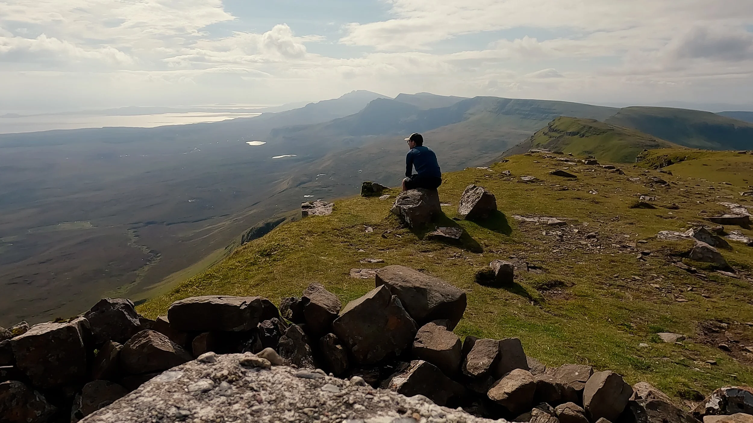
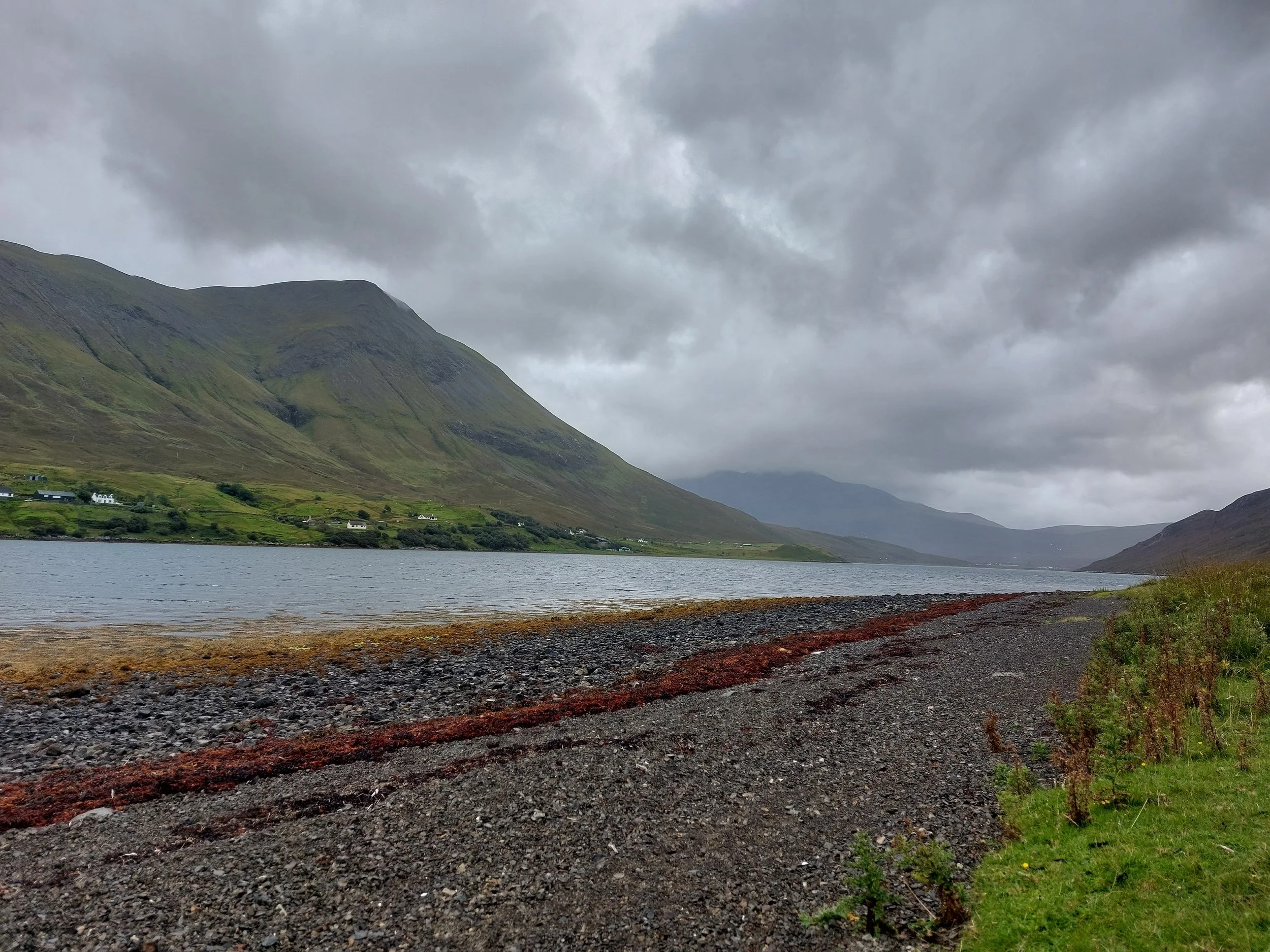
The Isle of Skye trail will take you into the heart of the island’s soul. Unlike the Alps, you won’t be treated with glaciers in one direction, towering snow-capped peaks in the other and enchanted forests straight ahead; the island is a shy character of our novel, they will beat you back with wind and rain (lots of it), but every now and then, after you give enough patience and determination, the island will let you into a glimpse of its soul. The skyes will clear and in front of you will be a view more magical than many other places I have seen. For me, that is the beauty of this hike. It is a journey of patience and determination that will reap an unforgettable reward.
I completed the hike in the end of August 2025 over 6 days. Below, you will find all the tips I gained along the way as well as some highlights from my trip!
How difficult is the hike?
The Isle of Skye trail is moderately challenging hike, but it’s difficulty largely depends on the weather conditions you face.
Trail condition - poorly mainatained in many stretches of the trail.
Steepness - little to moderate experience when tackling the elevation on the hike. No scrambling and little hiking on steep to very steep hills.
Trail length - scattered hostels / campsites along the path. Wildcamping will allow you more flexibilit to split the hike to your ability.
Weather - highly variable, extensive rain and winds are likely. You must be prepared for challenging conditions!
Obstacles and wildlife - the only animals you will find crossing the trail are sheep.

Highlights of the Hike
These are my top three memories and locations from my journey along the Isle of Skye Trail:
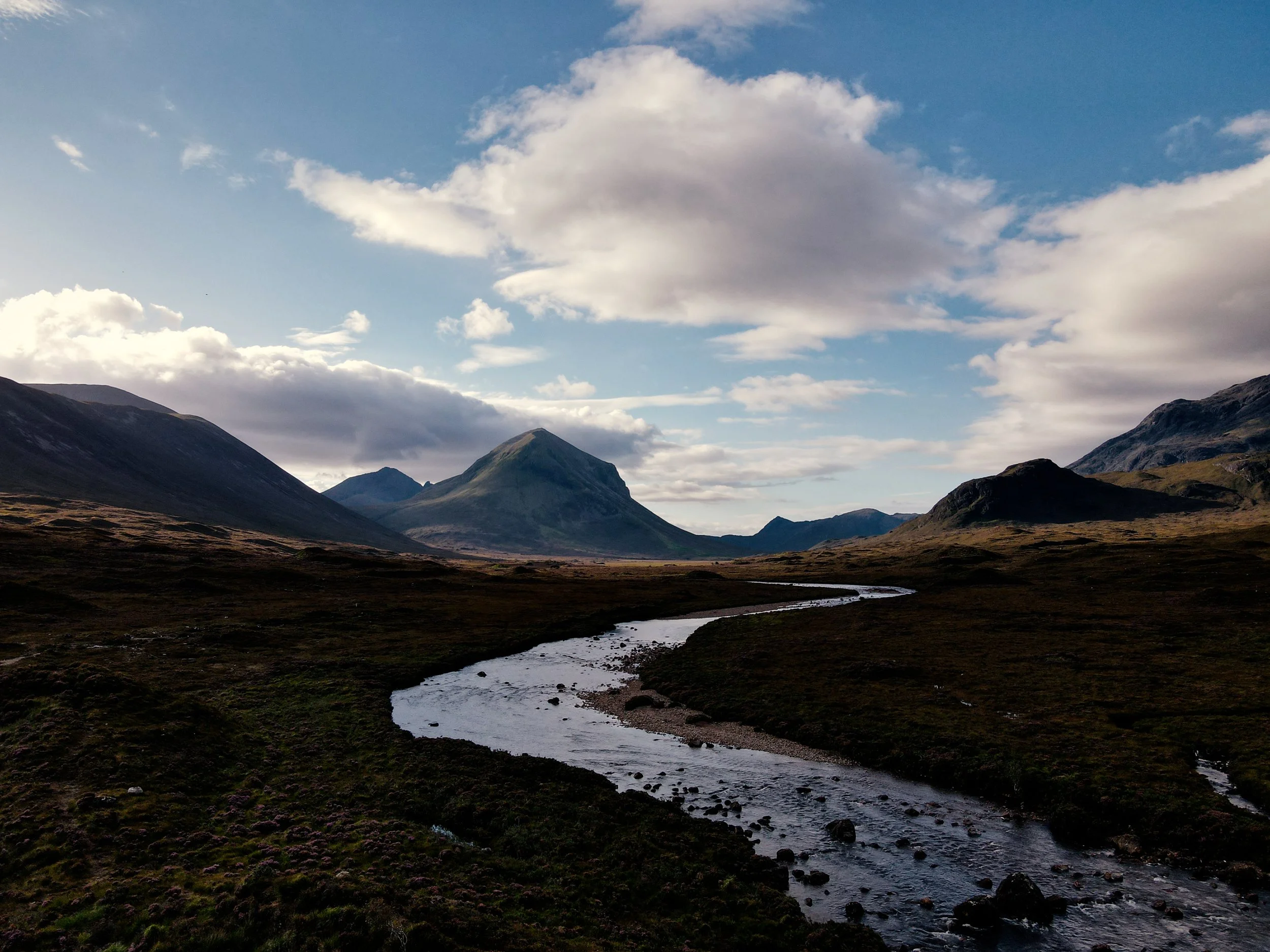
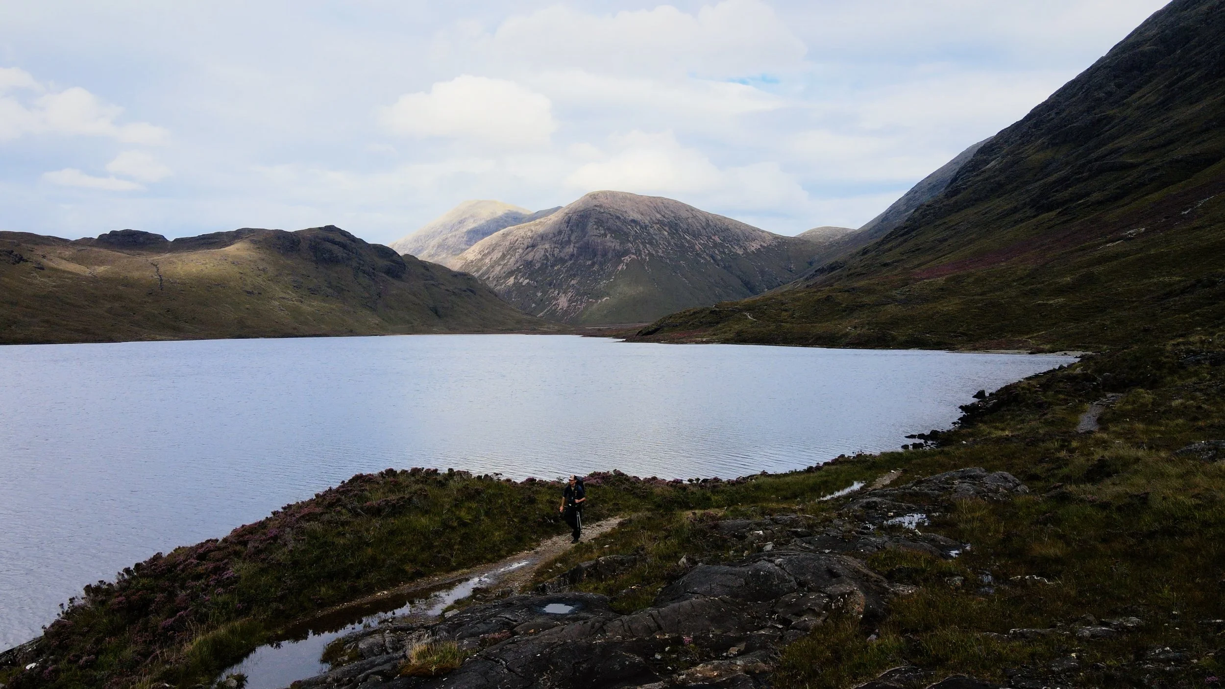
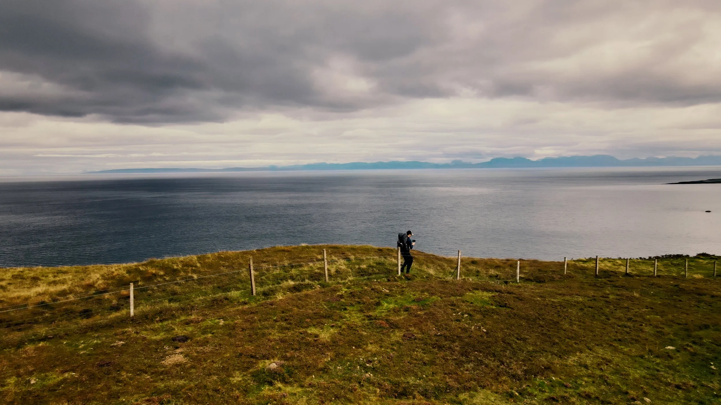
Loch na Creitheach to Camasunary
Totally alone, free from the crowds at Sligachan, the trails winds its way along lakes and through valleys until the wide expanse of Camasunary. The views along this stretch of trail were breathtaking. I felt as though I really was on the edge of the land, only the vast sea and its thunderous waves lying ahead of me. The trail is well maintained, and little elevation allows you really to focus on the views alone.
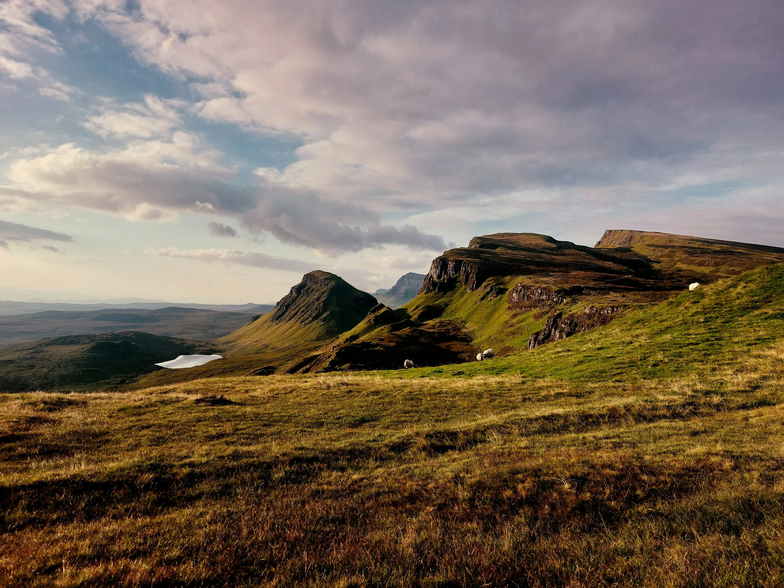
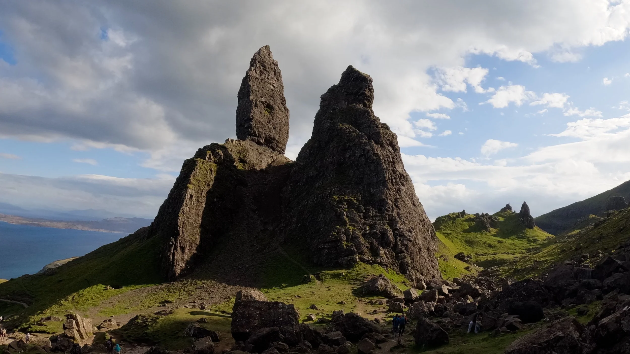
Old Man of Storr
One of the highlights of the island, whilst this attraction is heavily visited by tourists, there is a reason for it! Quite how the needles of rock are staying upright is a question only the power of nature can answer. After a long day’s hike along the Trotternish ridge, reaching the Man of Storr felt like a little treat to finish the day.
Sunset at Elgol
I was treated to a spectacular sunset after reaching Elgol. I sat on the rounded pebbles of the beach, watching the tide sway inwards as the sun fell downwards. The peacefulness of the scene was truly a highlight of the trip; I was surrounded by calm waters, with only my thoughts as the skye turned bright orange.
When to go?
There are a couple of things to keep in mind when deciding when to embark on the trail:
-
The best time to walk the Skye Trail is from late May to early September, when you will benefit from long daylight hours and generally more settled weather. However, Skye is known for its unpredictability, and it is perfectly possible to experience sunshine, low cloud and heavy rain in the same day, so it is wise to pack for all conditions and stay flexible with your plans.
-
You guessed it… Summer Holidays! Scottish summer holidays run from end of June to the middle of August, so expect these times to be more busy.
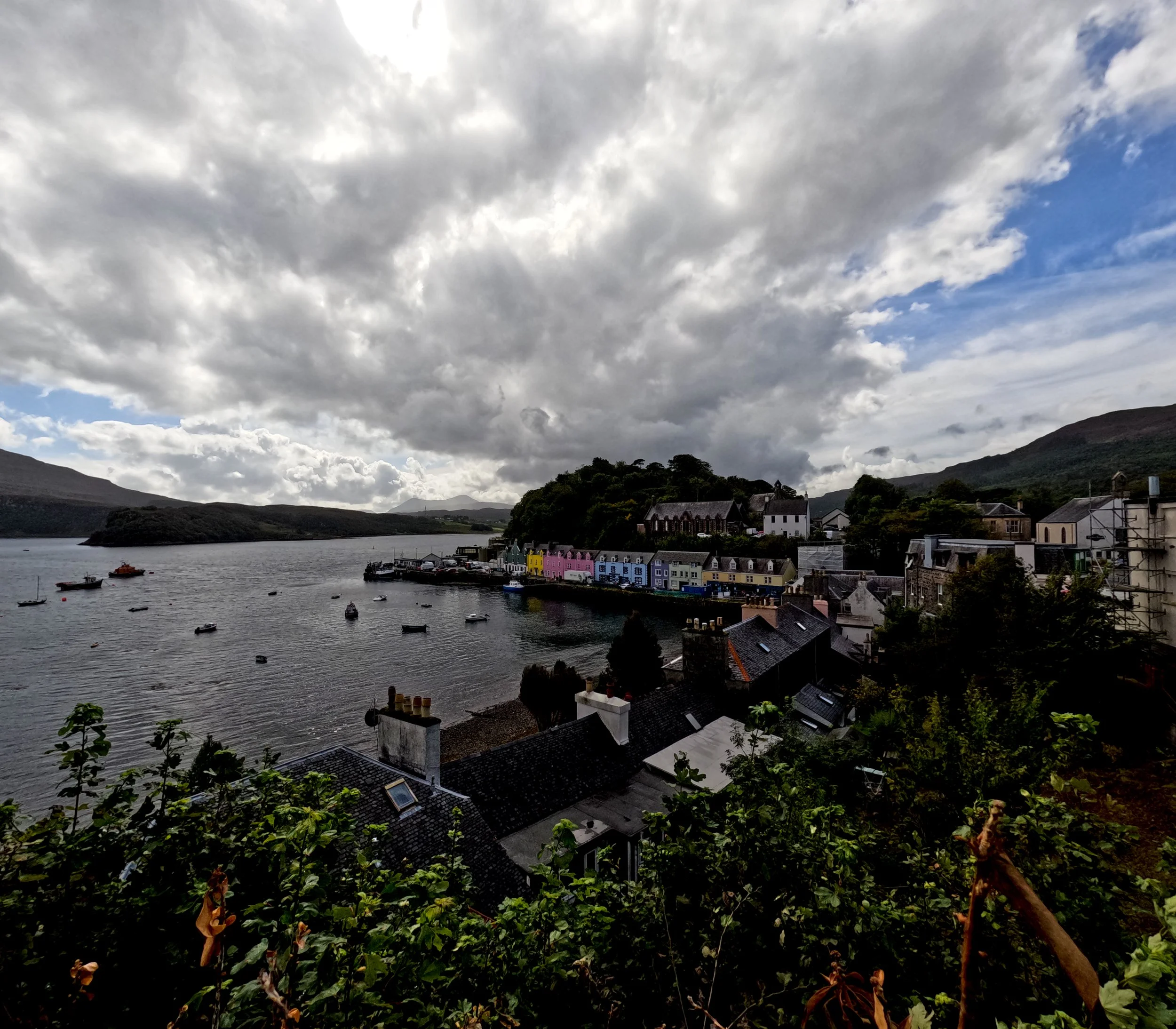
However, the trail was generally quiet, barring the several tourist attractions you pass along the way (Man of Storr, Portree, Sligachan)
-
Midges are small, flying insects resembling mosquitoes, often found in swarms near water bodies. They are particular prevalent in the summer season from end of May to September. You MUST bring a midge net hat and also possibly midge repelant. Midges are most commonly around when the wind is low. Whilst the summer season gives you the nicest weather, there will also be more midges!
The up side to rain is midges won’t be around, but generally when I went in late August, I was using a midge net when at camp.

Weather
The weather on the Isle of Skye is famously unpredictable. The island’s rugged topography, exposed coastline and mountainous interior (particularly around the Cuillin) create rapidly changing conditions. Atlantic weather systems move in quickly, and it’s not uncommon to experience sunshine, strong winds and heavy rain all within the same day.
Moist air blowing in from the Atlantic is forced up over the hills and mountains, where it cools and condenses, often bringing sudden showers, low cloud and poor visibility. Forecasts can change quickly, and localised conditions in the hills may differ significantly from those at sea level.
Top tip: Don’t rely on a forecast more than 24 hours ahead. Conditions can change very quickly, so you must be prepared for all types of weather, even in summer. It’s not unusual for a grim forecast to improve at short notice — and equally, for good weather to turn unexpectedly.
Waterproofs are absolutely essential, including a proper waterproof jacket, trousers boots. At the same time, you should pack sun cream, sunglasses and a cap — clear, bright days are common too. Midges can also be an issue in warmer, still conditions, so midge repellent and a head net are well worth bringing.
You won’t normally need crampons during the summer months. However, winter conditions in Skye can be serious and highly unpredictable, particularly in the Cuillin, where snow, ice and high winds are common. The trail is remote and largely unmarked, so winter travel should only be undertaken by highly experienced and well-equipped hikers.
Weather Forecasts


Getting to the Isle of Skye
Plane
The closest airports around the Isle of Skye are:
Glasgow
CityLink bus connection to Portree (Isle of Skye) - approx. 6 hours
Edinburgh
CityLink bus connection to Portree (Isle of Skye) - approx. 8-9 hours
Inverness
CityLink bus connection to Portree (Isle of Skye) - approx. 3 hours
ScotRail train to Kyle of Lochalsh (2 hours 50mins). From Kyle, you will need to take a bus / taxi across the Skye, more on this below!
Bus
As mentioned above, buses from the major cities and towns around Scotland are available. The key advantage of taking a bus over a train, is that the bus will get you to Portree, meanwhile the train terminates at Kyle of Lochalsh, across the bridge to Skye. This may sound minor, but as I found out taking the train, I had to wait until almost 11:00 the next day until the next bus which slowed me down greatly.
Regional buses
CityLink buses are the ones to go for! Check their website for buses to Portree. This will put you in the heart of the island. If starting from the north, you will likely have to take a taxi to Duntulm, more on this below!
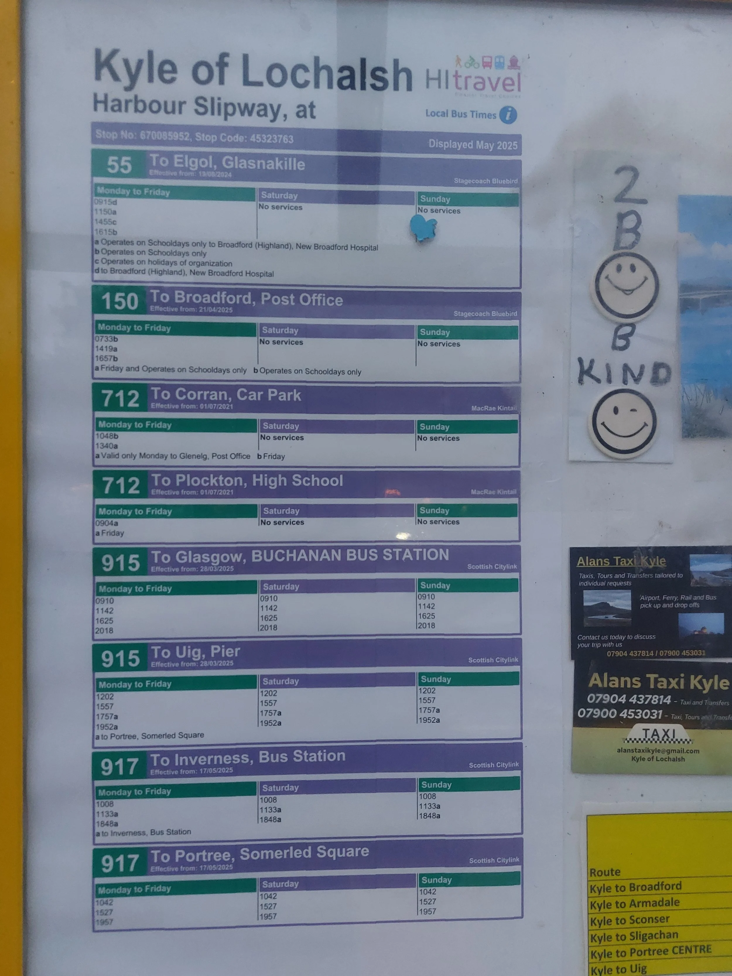
Local buses
Unfortunately, in 2025, local buses were reduced to save money. This means there are less buses (and none to Duntulm!). See the photo below of the bus timetable at Kyle of Lochalsh. To get to Duntulm, look at bus 917.
Taxis
Taxis are the most expensive form of travel around the island. Note, Uber does not exist! In 2025, my taxi journey from Portree to Duntulm cost £70!
Bring enough cash, as most taxis will not accept card.
Consider sharing one taxi with fellow hikers to split the cost, and be more sustainable!
Taxi numbers:
Lochalsh taxis: 07770 561 905
Alans Taxi Kyle: 07904 437814
Portree taxi (the one I used): 01599534323
BWS taxis (Portree): 01478 612865
Gus’s taxis (Portree): 01478 612444
Don’s taxis (Portree): 01478 613100
Accomodation
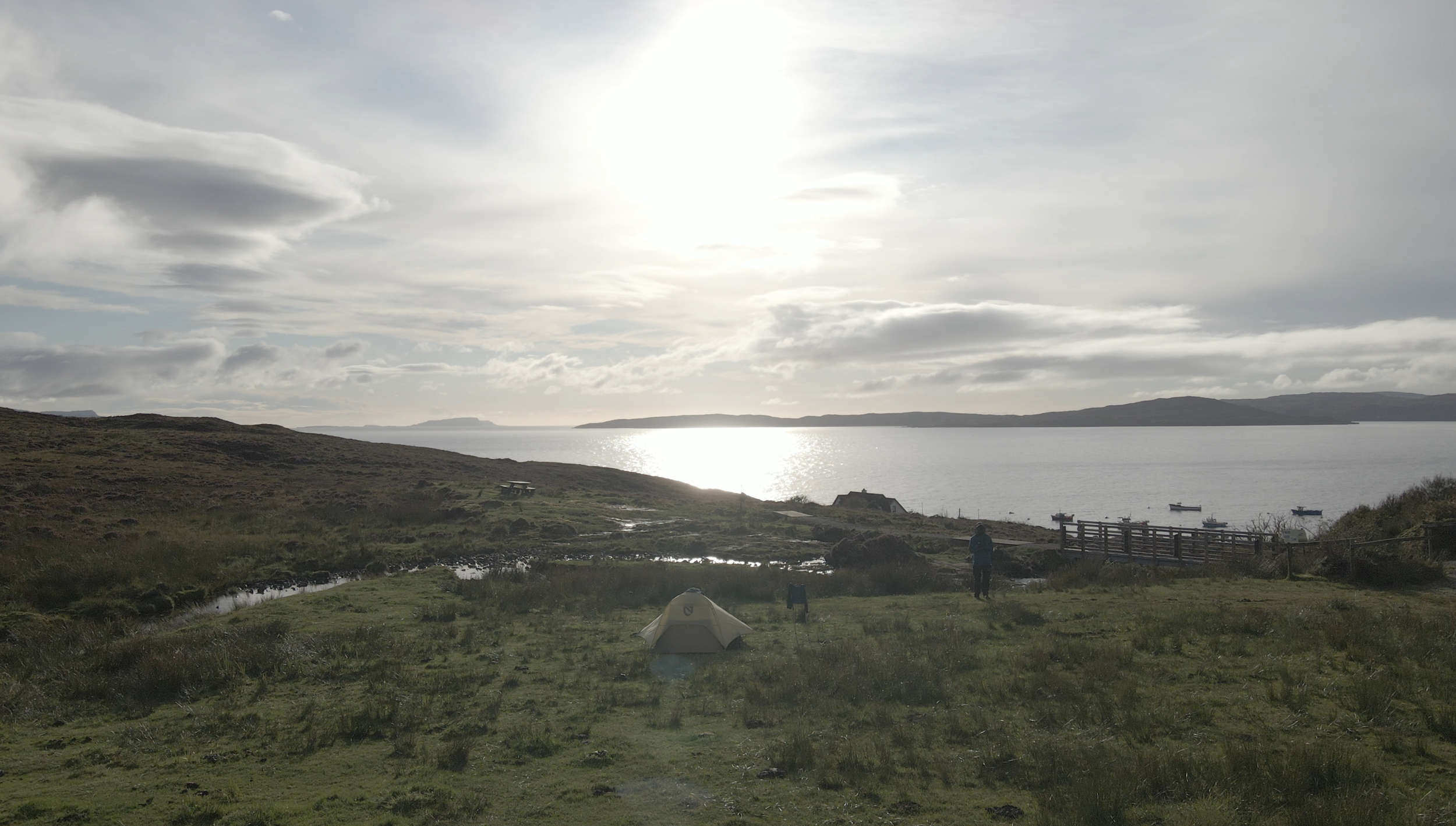
You will find a variety of accomodation along the Isle of Skye trail, and what you choose will depend on your specific needs and requirements. Below you will find a guide to camping, hostels and bed and breakfasts (spoiler, I am a big fan of wildcamping along the trail if you can!).
-
Campsites
Official campsites are sparsely populated along the trail. Generally, you’ll be able to have much needed shower, recharge batteries, refuill water and more. Campsites along the trail include:
Portree campsite (just north of Portree)
Isle of Skye camping pods (just south of Portree)
Sligachan campsite (I stayed here one night, it was great. They have a taco van which served as a very refreshing dinner). I was able to dry off after torrential rain during the day.
-
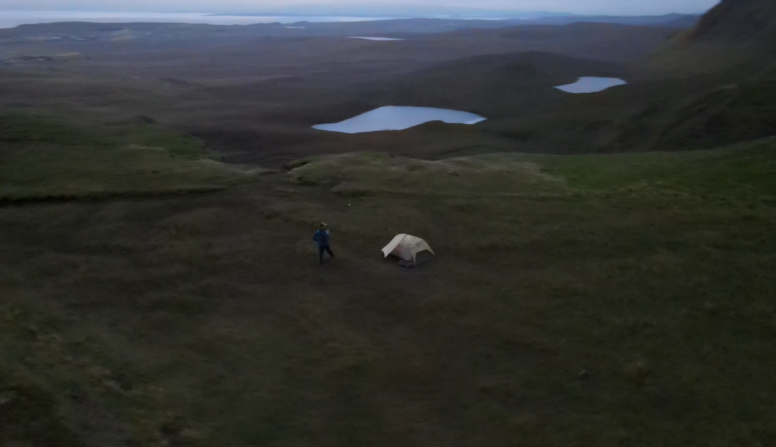
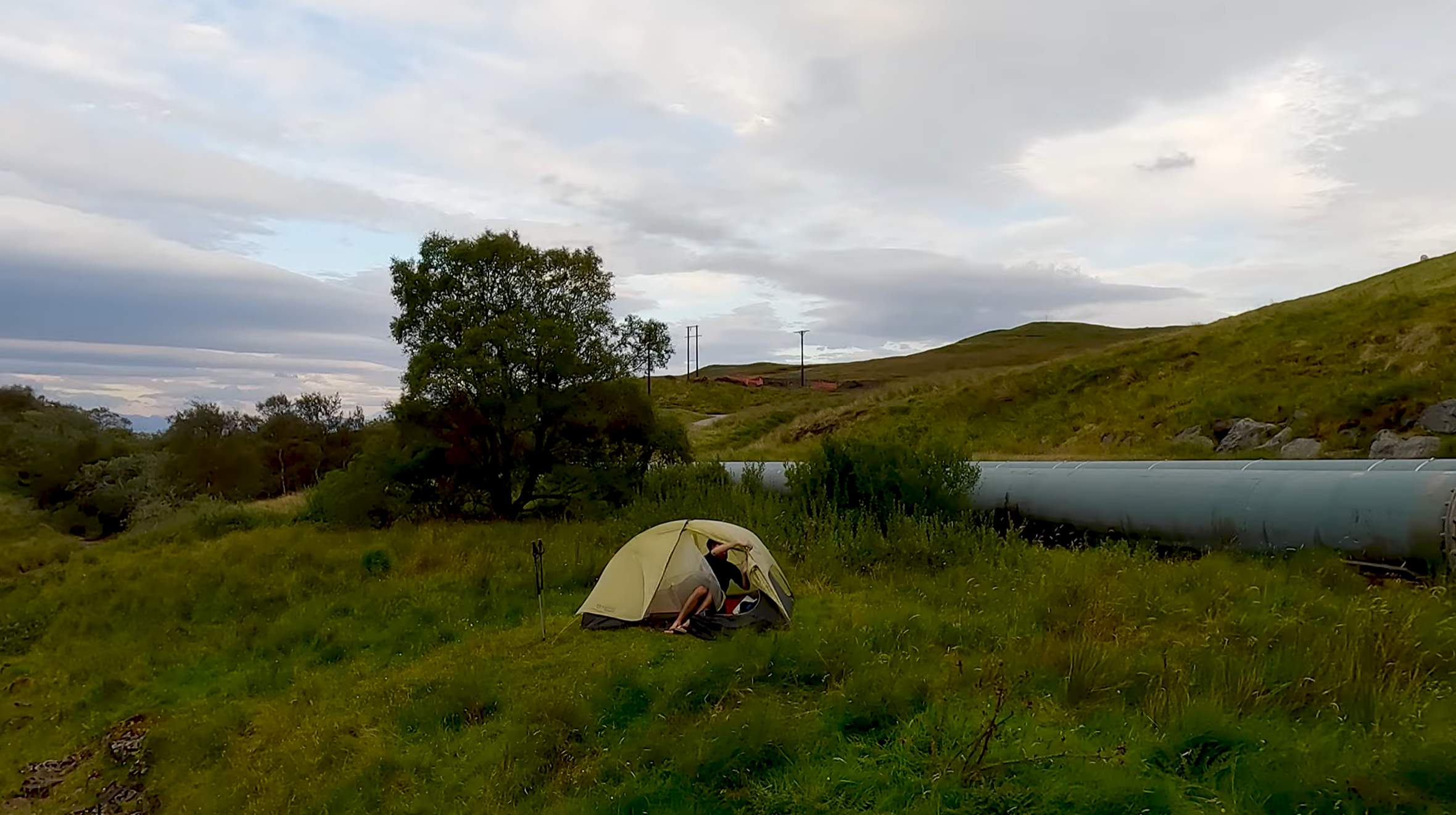
I’d highly recommend wildcamping when in Scotland. One of the few countries in Europe that allows (and encourages) wildcamping, it is a great way to be flexible on your hike.
See my wildcamping spots (highlighted yellow) in my trail map above!
When wildcamping, please please be respectful to nature bu leaving no trace.
-
Check out the location of hotels and bed&breakfasts in my trail map above! If you are planning this hike in the summer, do book early as they will sell out fast.
Some B&Bs will offer brekafast and a packed lunch for your day. I’d recommend asking in advance so you’re not left hungry!
Maps and Waymarking
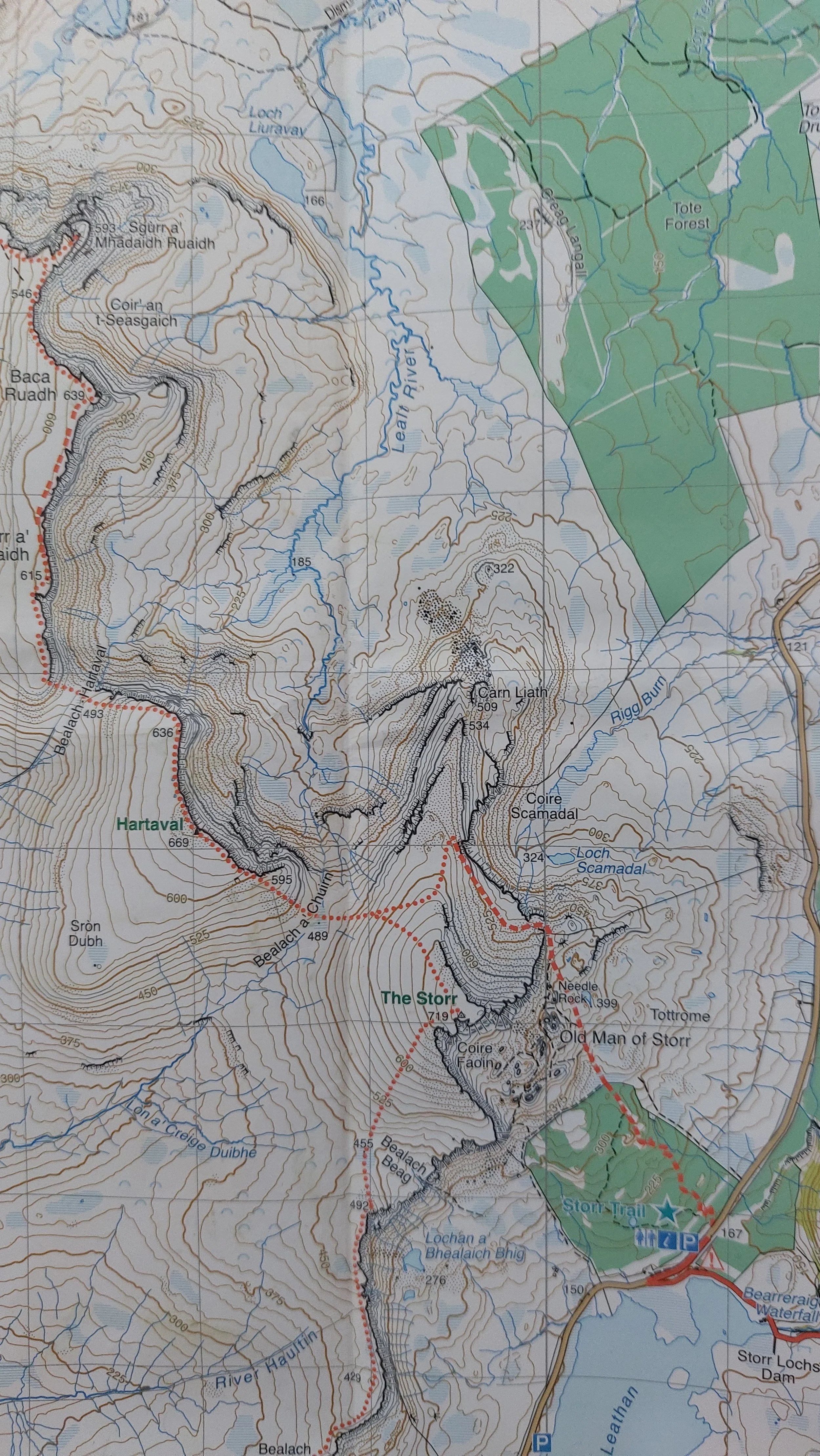
Maps come in two forms: digital or printed. Personally, I like the feel of a printed map as well as knowing its battery won’t die on you. Digital maps have advantages including often a GPS tracker, live weather forecasts and general ease of use and small size compared to a map. However, phones are dependent on battery life, sometimes internet signal and the performance of your phone can vary on a cold night or with heavy rain it may be difficult to use the touchscreen.
Maps require more planning. I like to draw the route out with a sharpie. Maps are often bulkier and the often cost between £10 - £20 each. However, self-navigating can be a rewarding and fun process on the trail. Don’t forget a compass too whe using a printed map.
Online Maps:
Some good online trail maps include:
Printed Maps:
This Sky Trail specific map, contains the full trail with a marking of the path. It is waterproof and very durable (which is needed for the variable wheather!)
I used this map with success. After multiple days of rain, the map showed almost no sign of wear and tear. As I’ll describe below, waymarking on the trail is quite challenging, therefore having a good map to rely on was really useful.
This detailed guide presents small maps divided into stages with descriptions of each stage. The maps are useful as they also contain photos to help prepare you for the trip / day ahead.
Waymarking
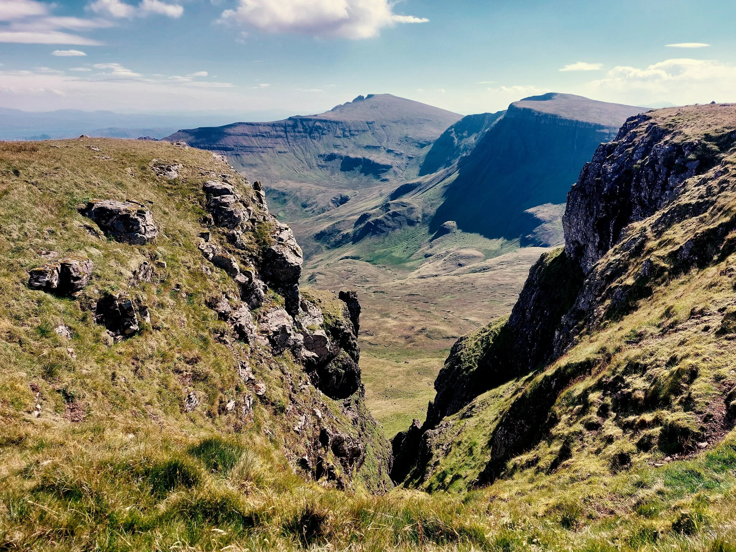
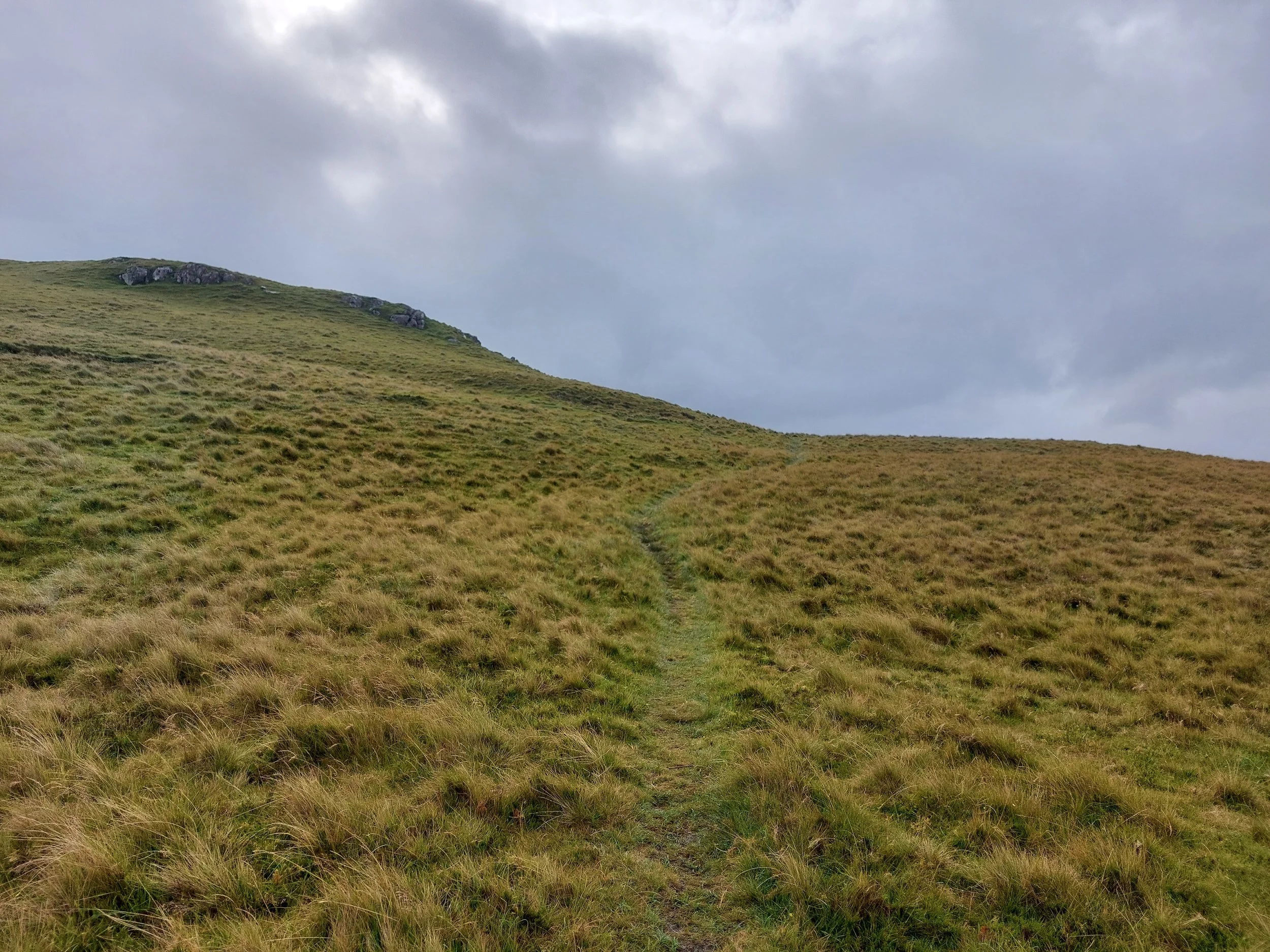
An extremely important section, waymarking on the Skye trail is often low to non-existant. Part of the beauty of the trail is the low numbers of hikers and freedom you have along the trail, but the drawback is that there are almost no waymarkers and often the path can be difficult to find (especially in poor weather)!
Tips to stay on trail:
Check your compass regularly. A compass is a great simple check to see if you are hiking in broadly the right direction.
Don’t solely rely on hikers ahead. Just because you see people ahead of you, doesn’t mean they are hiking the same trail or they are on the right path!
Don’t be worried to trace back your steps. If the trail doesn’t feel right, you may well be off the main path. In this case, it’s often very important not to go looking for shortcuts back onto the trail, but to retrace your steps until your last known correct checkpoint.
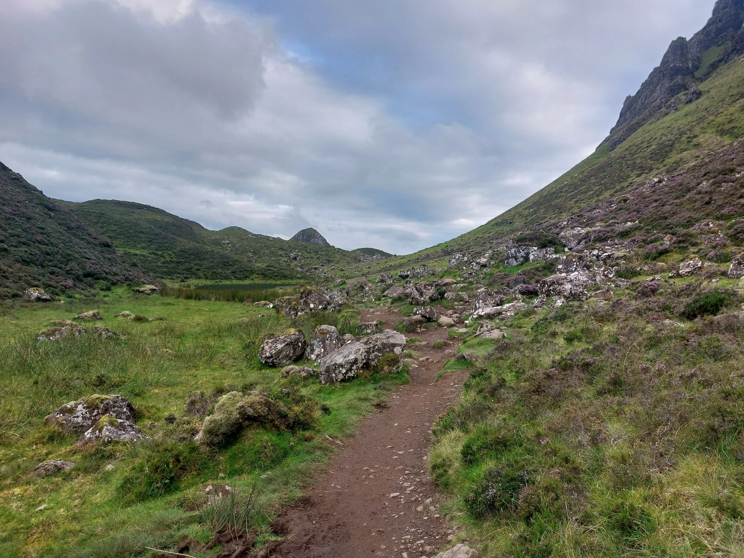
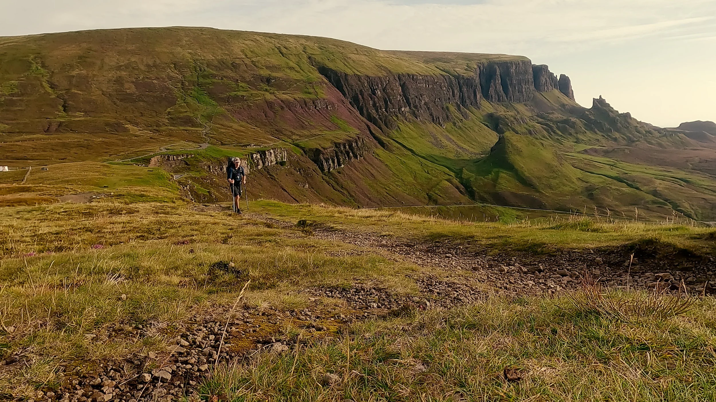
A well-defined trail
Typical visibility of the trail
Walking on gravels without a clear path
Food options
There are many restaurants and hotels / campsites offering food for all hikers along the route. See my map in ‘The Route’ for food options as well as the location of accomodation (the hotels will serve food). In addition, many campsites and hotels operate small shops selling snacks, gas canisters, drinks and other foods. I stopped for delightful tacos at Sligachan campsite. Another highlight was Cafe Elgol; the couple working at the Cafe are both lovely and served delicious food and drinks (especially the sweet treats!). I also stopped there for breakfast where I had a bacon and sausage roll and a hot chocolate.
Many accomodations offer to pack breakfast for you as you depart for the hike. In addition, the more major towns along the route (Milngavie, Crianlarich, Drymen and Kinlochleven) offer shops for resupply.
Local ‘must-tries’
Scotland is home of some great and unique food which I highly recommend you try.
Haggis: a savory Scottish delicacy crafted from finely minced sheep's heart, liver, and lungs, blended with oats, onions, and spices, delivering a rich, robust flavor. Perfectly paired with neeps and tatties, it's a culinary adventure that tantalizes the taste buds with tradition and authenticity.
Fish and Chips: a really divise one outside the British Isles, fish and chips are a timeless British classic featuring crispy battered fish, tender on the inside, and golden-fried chips, served piping hot for a satisfying crunch with every bite. A beloved comfort food that promises a deliciously indulgent experience, enjoyed by generations and cherished on every corner of the high street.
Whiskey: whilst not quite food! experience the essence of Scotland in every glass, with smooth, smoky flavors and hints of heather honey that capture the spirit of the Highlands. Savor the craftsmanship of local distillers, whose dedication to tradition ensures each sip is a journey through Scotland's rich heritage and rugged landscapes.
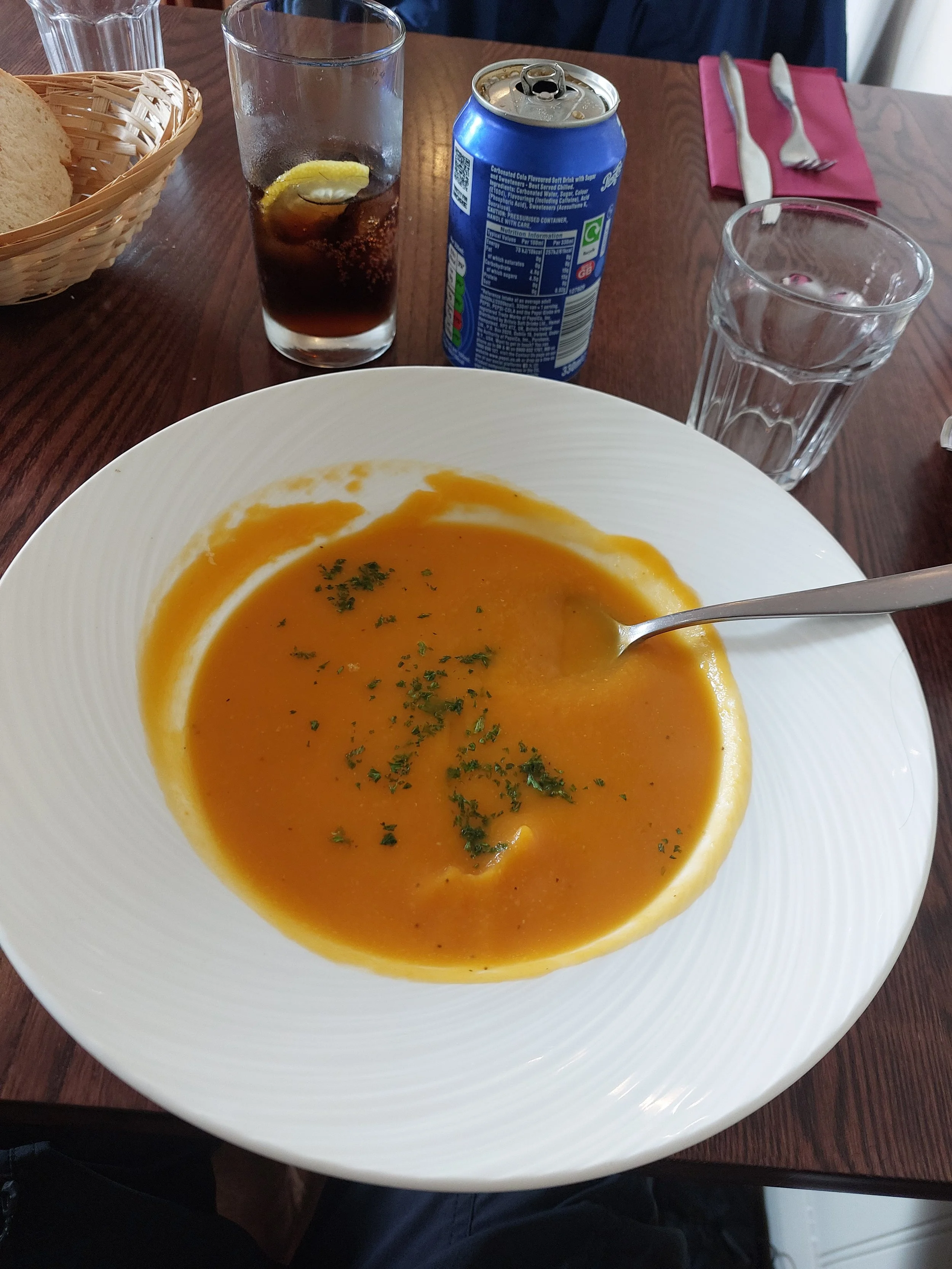
Soup at the Cuchullin, Portree
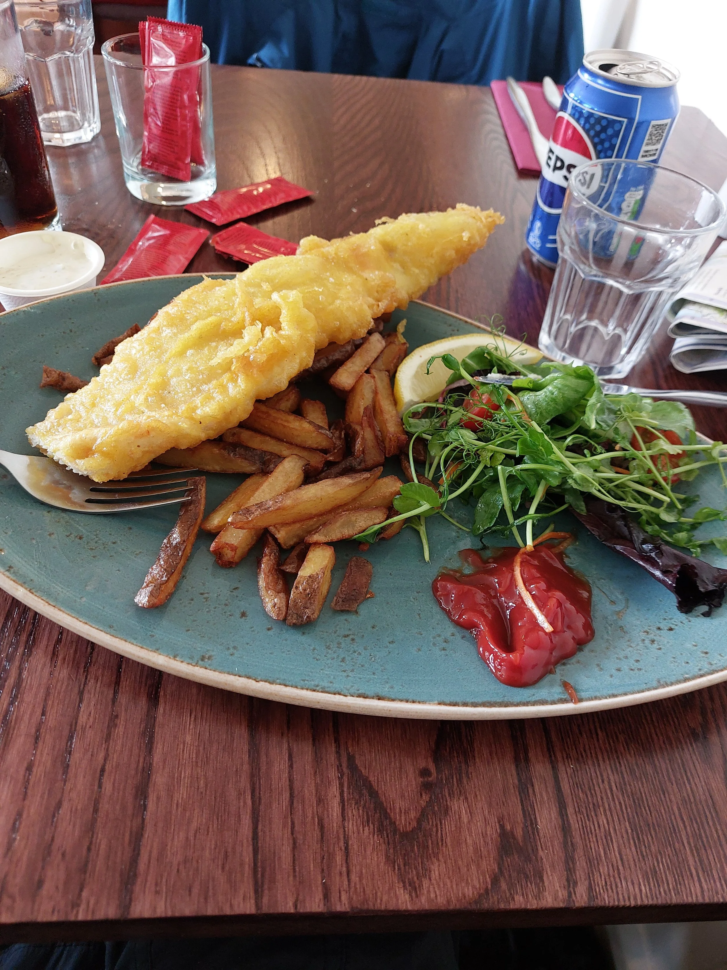
Fish and Chips and the Cuchullin, Portree
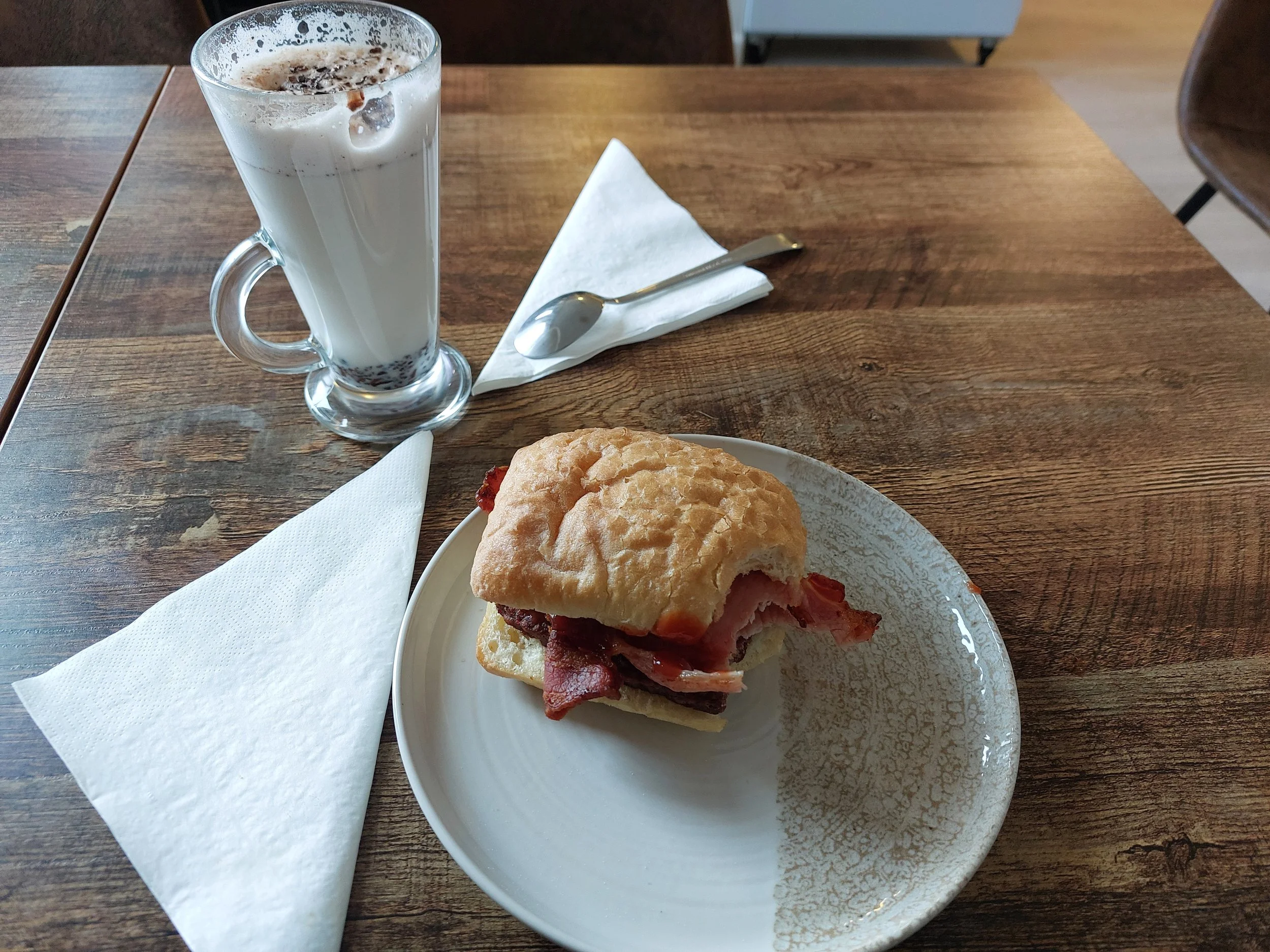
Breakfast at cafe Elgol
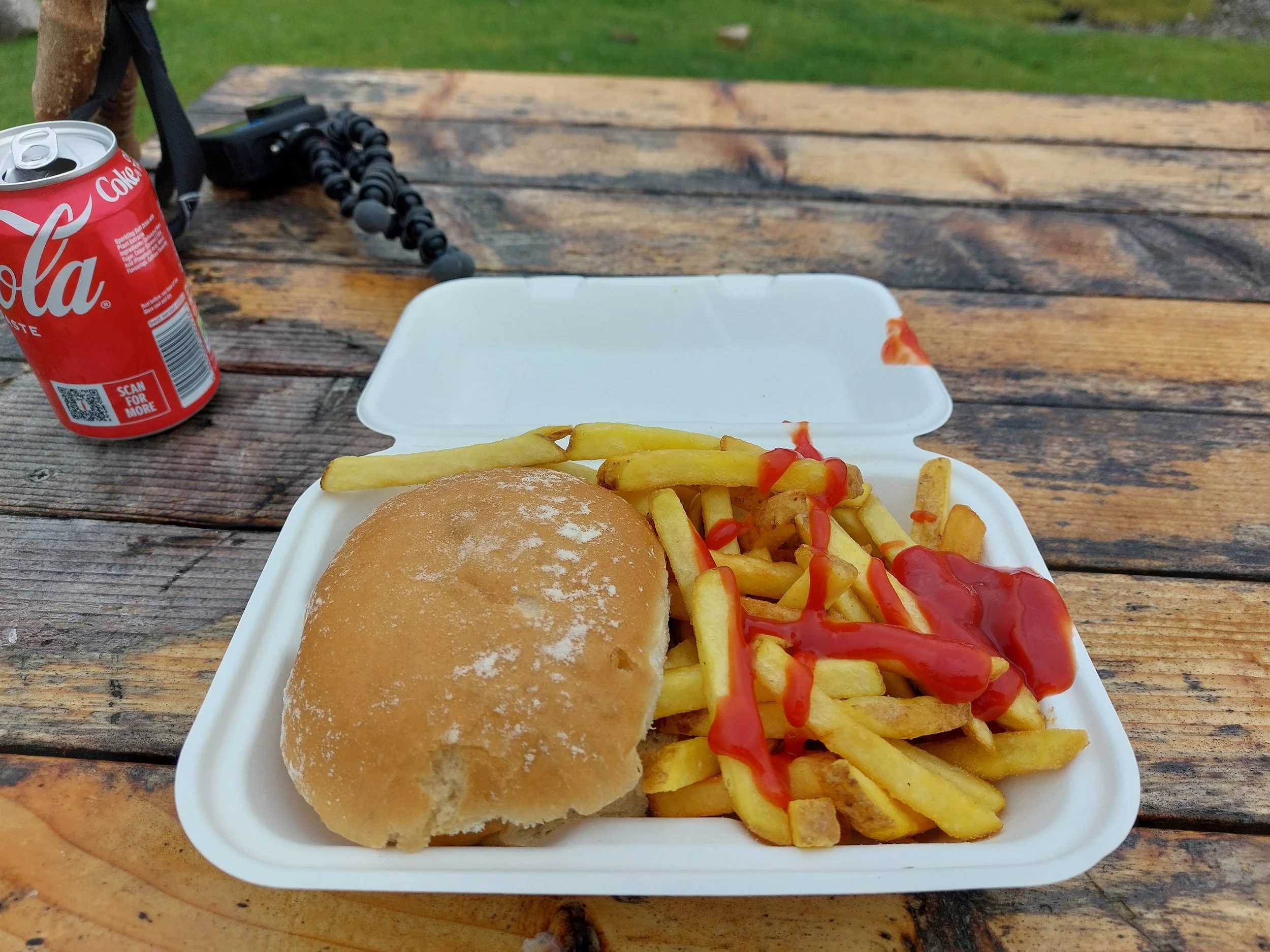
Lunch at Torrin (from a trailer serving burgers just ahead of the town)
Cash or Card
Answer: Cash (but can get by well with card)
Currency: British Pound Sterling (£)
Card payment can be done in supermarkets, local buses and most restaurants.
Taxis generally only accept cash.
ATMs are available in Portree and Broadford.
Always bring enough cash for an emergency (e.g. a night’s sleep, and a couple meals). Not only could it come in really useful, but your mind will be more at peace knowing you have a back up in cash.
Phone and Internet
WiFi
Most accomodation providers will provide WiFi, but do check when booking. I relied mostly on mobile data, except for in Elgol where I needed the WiFi from the lovely cafe Elgol due to the lack of mobile data.
Mobile data
Check your phone provider for more information. By searching e.g ‘Vodafone Coverage Map’, you will be able to find out with regards to your provider. As the UK is not part of the European Union, check you mobile providers provides coverage if you are coming from the EU.
Phone signal is vairable, you will likely not have a coverage entirely during the trail. Check your map for valleys coming up (signal often does not reach them!). In addition, I didn’t have signal at Elgol at all, so if you are staying the night there, I would advise on letting loved ones or friends you are in contact with know that you may not be reachable. However, Cafe Elgol does have Wifi when open.
UK network providers with a tourist card option:
Charging
Scotland uses the UK standard 3-way plug. You will need an adapter if coming from overseas (Europe included!), although some countries share the plug including: Malta, Singapore, Hong Kong, Ghana and Nigeria. Restaurants and accomodations generally have plugs available that you can kindly ask to charge your device at. Consider bringing a portable charger for multiple devices / if camping.
Important tip: often in hostels / campsites, everyone wants to use the limited power sockets. So many plugs in a tight space may make the space congested. Often, bulky, large adapters may not fit into a socket. Consider buying a UK charger outright or bringing a power bank to overcome this problem.
Key Contacts and Emergencies
Dial 999 or 112 for ALL emergency services including Ambulance, Police, Fire Service and Mountain Rescue.
Mountain rescue in the UK is free of charge as the service is volunteer based.
Make sure you have adequate insurance cover. It is advisable to leave a copy of your insurance with a member of family or friend, and take the original with you. As of 2026, EU citizens are eligible to reduced cost (sometimes free) urgent medical treatment through the European Union Health Insurance Card (EHIC), but do check the latest regulations when you travel.

Further References
There are some great ways to get further information regarding the hike! These three resources are where I find out most about any hike, not just the Skye Trail.
-
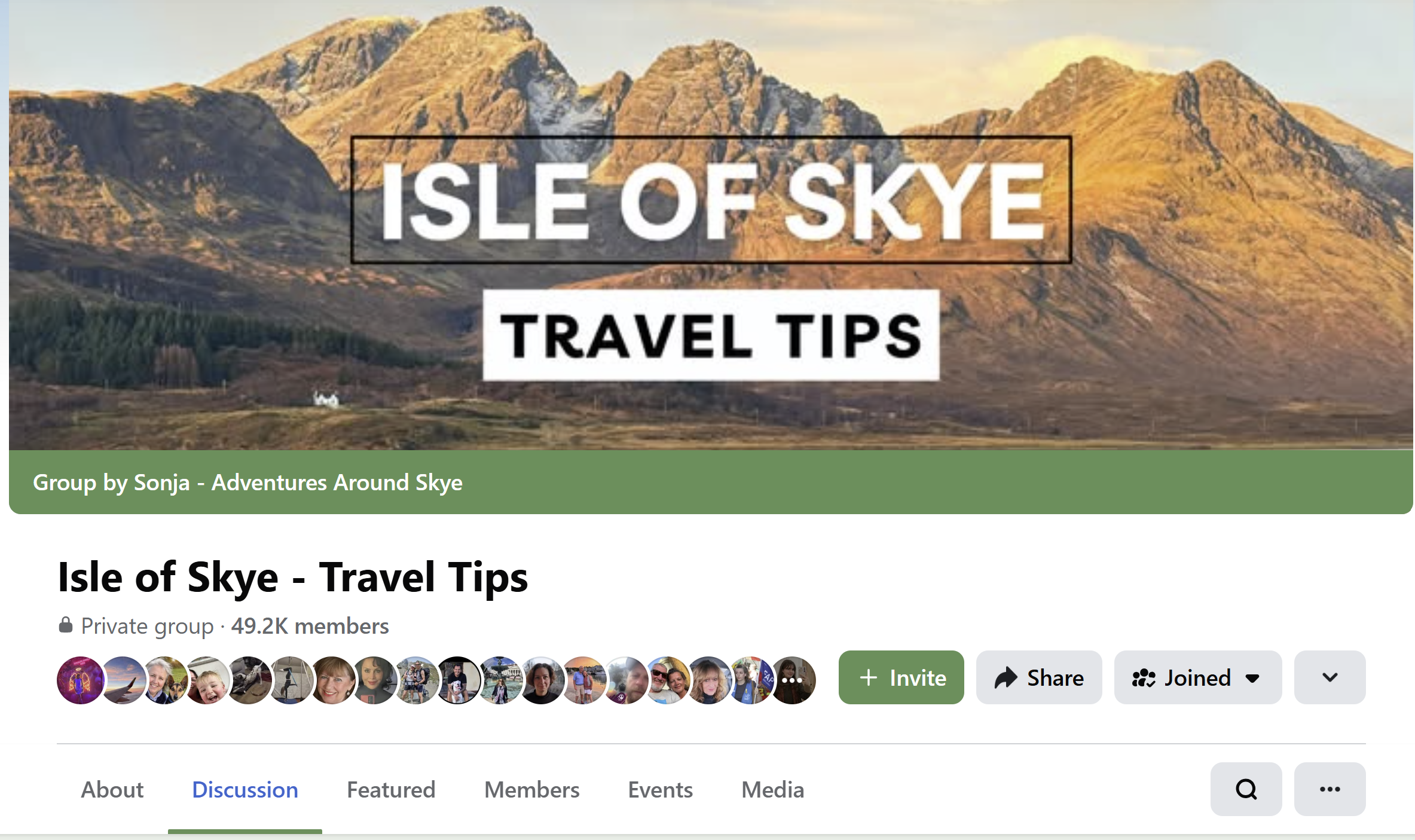
One of my most underrated souces of information, there is a facebook group for any hike out there. In the case of such a popular walk, there are many groups with thousands of members each.
Ask any question, read other questions, other posts, a faebook group is just a trasure trove of informtion. I can guarantee any question will get answered.
In addition, checking groups on the day of hiking can give important updates on the trail condition or anything ese to be aware of.
-
To get a real sense of the feeling of a trail, there is no better site. YouTube offers a unique insight where words on a page simply are not enough. When watching a video, try and look out for things like busyness on trail, the path condition at the time of year and small details like sources of water, streams etc.
Most youtubers (below 10,000) subscribers will answer questions you may well have as well, I certainly do!
Finally, plug for my own video… I’ve tried to express my thoughts and feelings during the video as well as sharing some stunning scenary, so check it out!
-
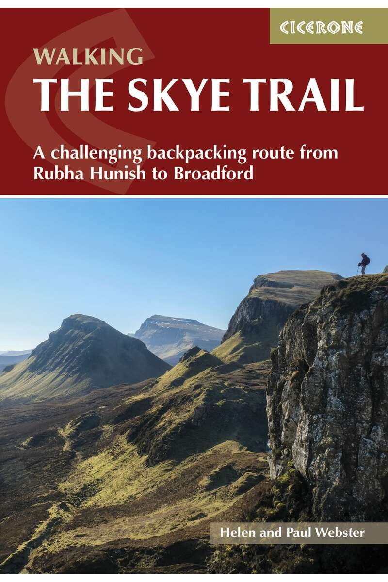
My go to guides are always Cicerone.
For £10 - £20, the level of detail is second to none. Detailed descriptions of each stage, many key facts, a 1:25,000 map, the guide is well well worth it.
You will be able to learn abut the local area’s deep history as well as the geology of the area through this guide.
YouTube is a great source of information, not just my video! ; )